
Exploro del mundo, narro historias y siempre soy un sujeto tangencial. Recorro lugares que no sabías que existían y los convierto en relatos visuales y escritos.
Urban Renewal of Colon, Panama
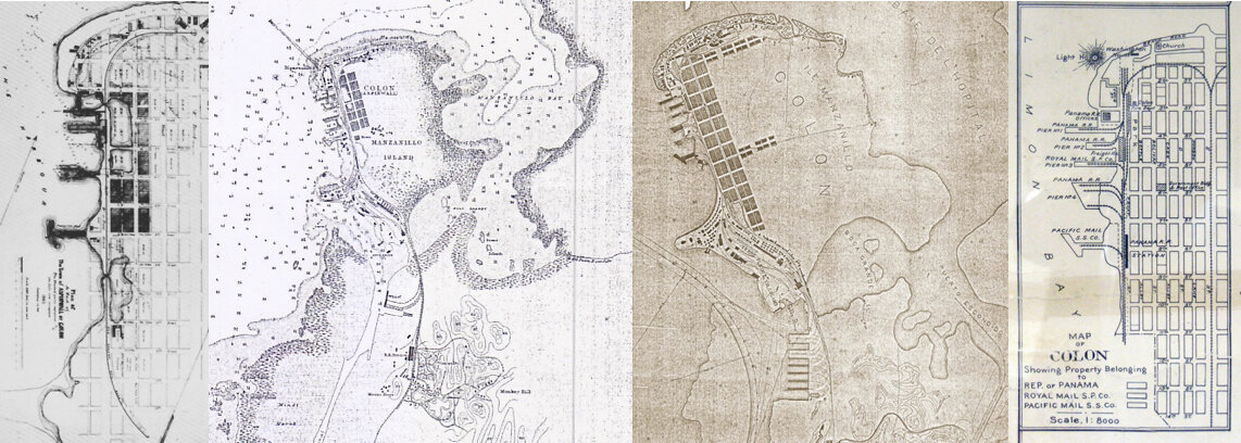
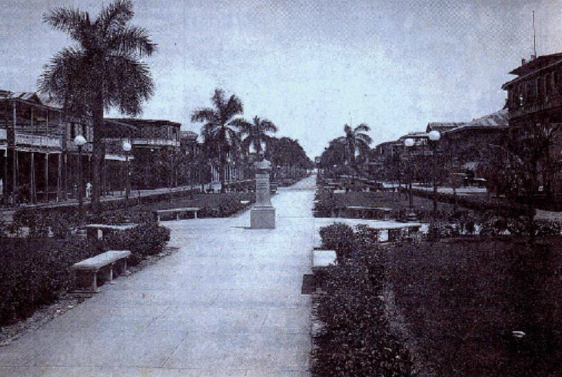
Columbus was created in 1850 by the Panama Railroad Company «Panama Railroad Company«, a company established in New York in order to build a trans-istmic railroad. Therefore it is one of the oldest railway cities in America. This city emerges as a utilitarian camp and subsequently had great transformations until establishing an orthogonal urban line of great heritage value, since it follows the urban guidelines of the time in the US, with its own elements such as the 300-block block. 300 feet with an "alley through the middle" and "street parallel to the railway."
The value of the site is expressed through various attributes or physical elements (design and material) and symbolic (use), as well as the relationships between them. These attributes are the concrete objects of the protection of the historical center; It is therefore necessary to maintain them so as not to lose the values of the site (UNESCO 2008: 21ff.).
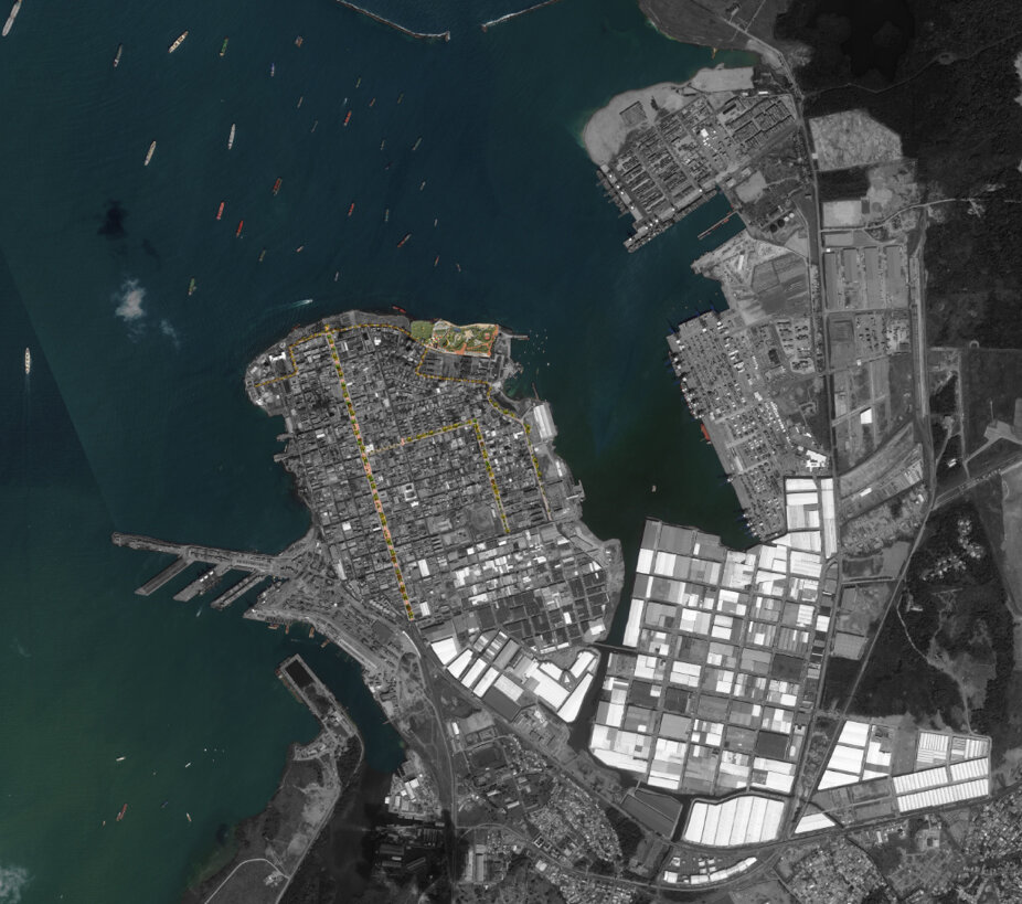
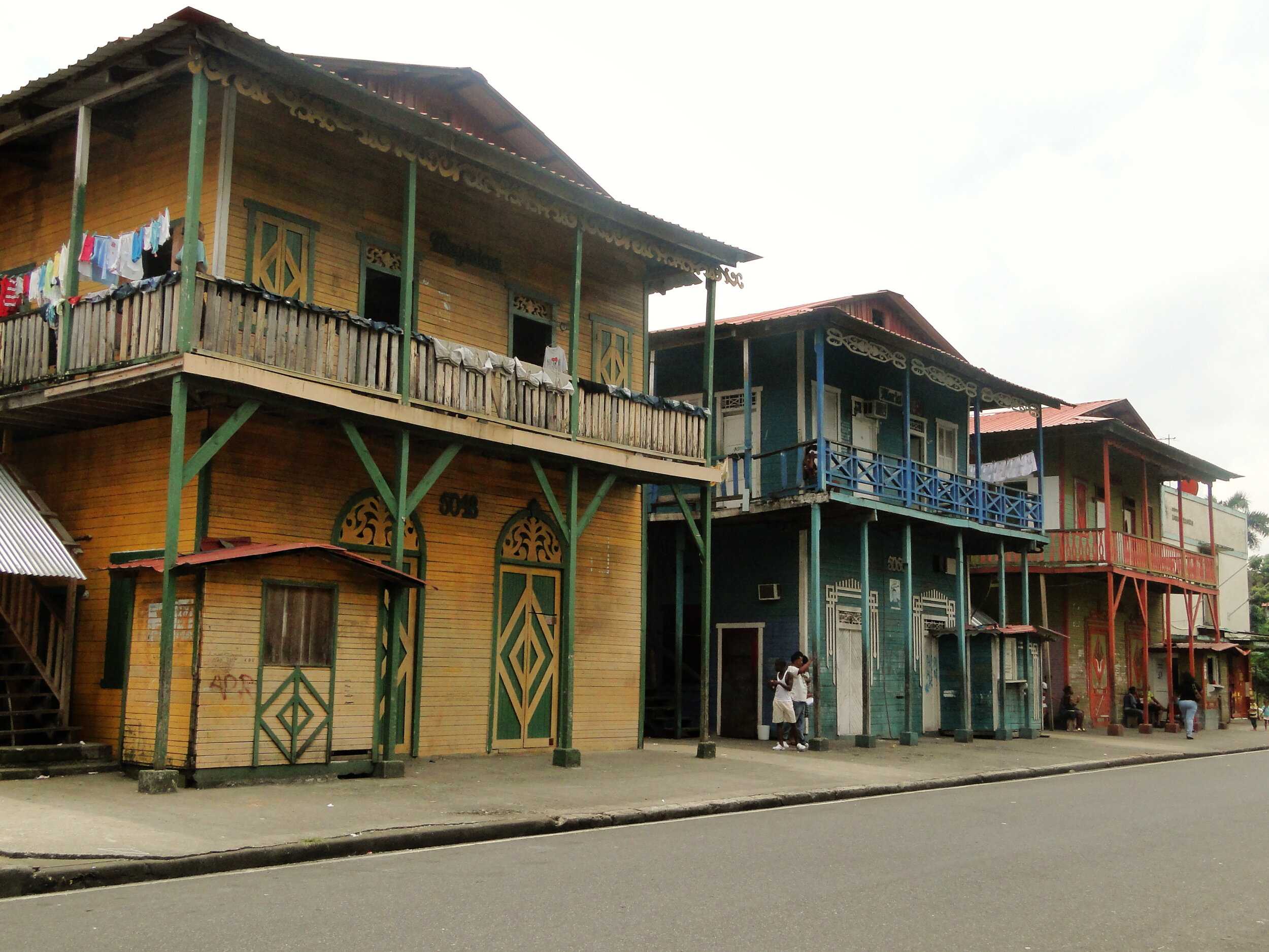
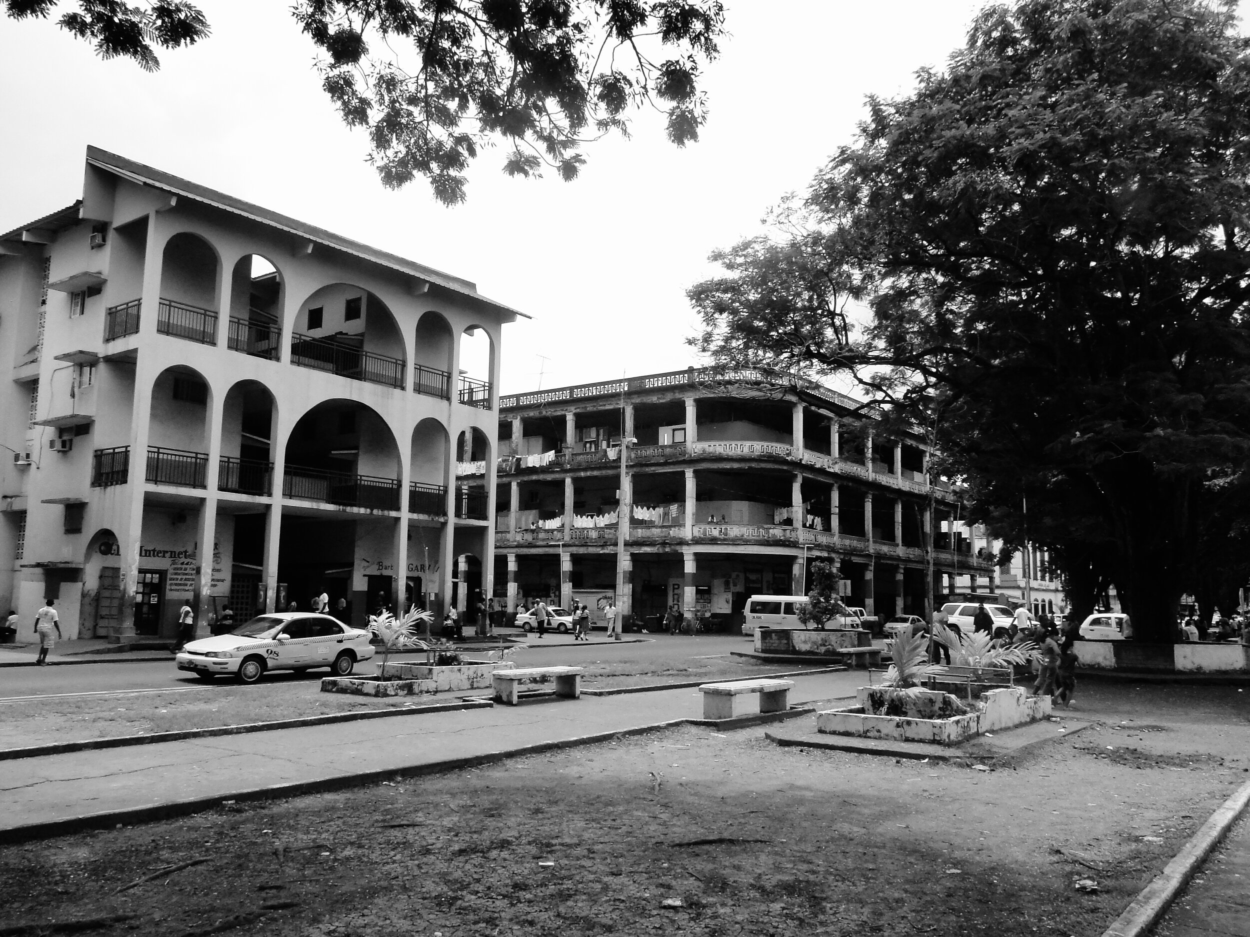
Its historical center mainly highlights the relationship of the city with the port, rail and Panama Canal activity; the examples of the trace and architecture of the city over a hundred years (1850-1950) and the adaptation of French and Anglo-Saxon architecture models to a city in the tropics (balconies and portals).
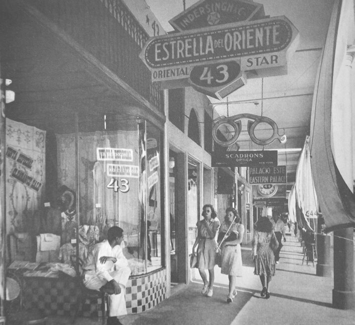
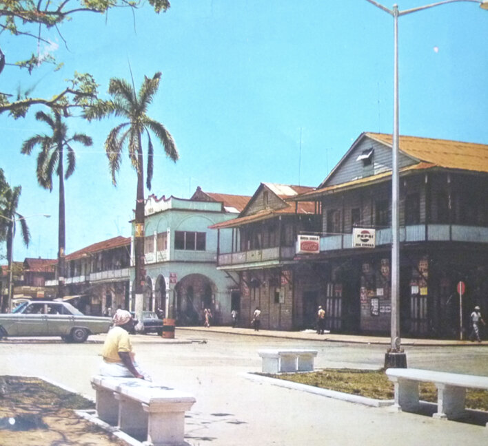
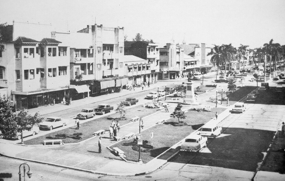
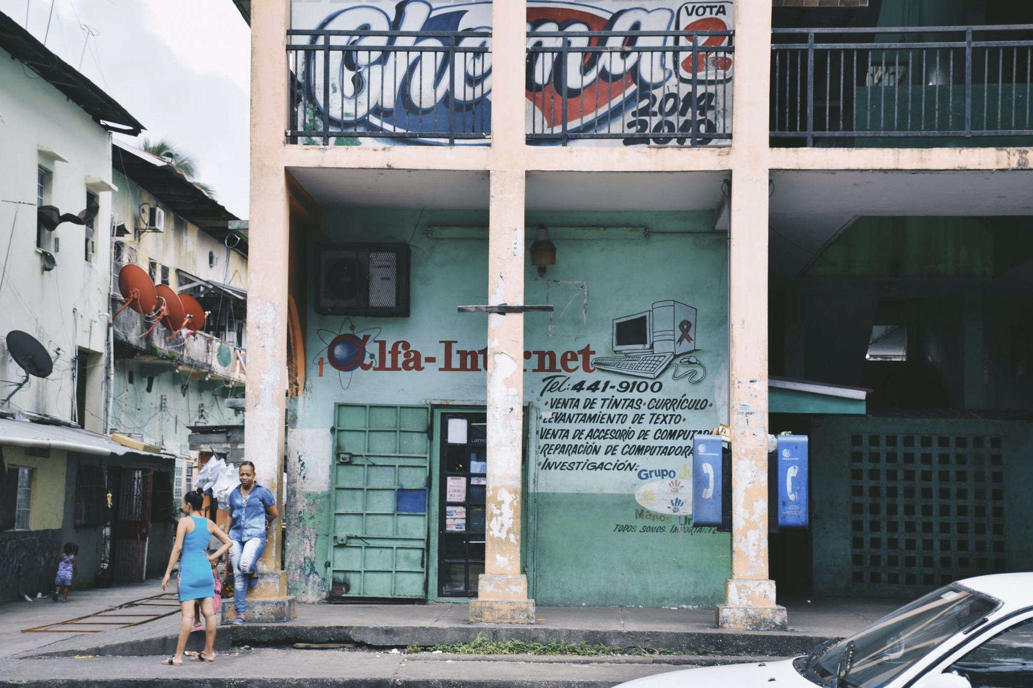
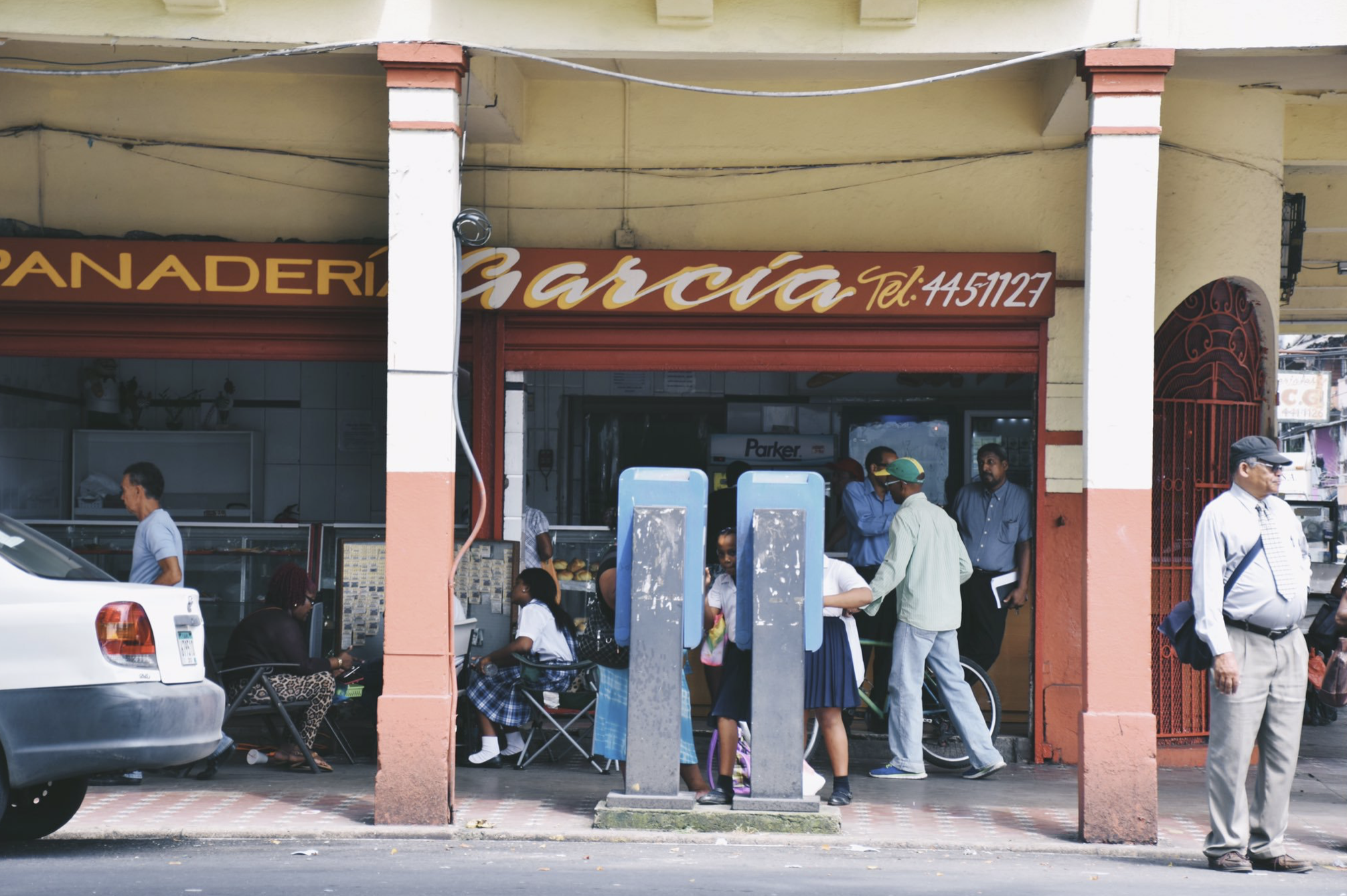
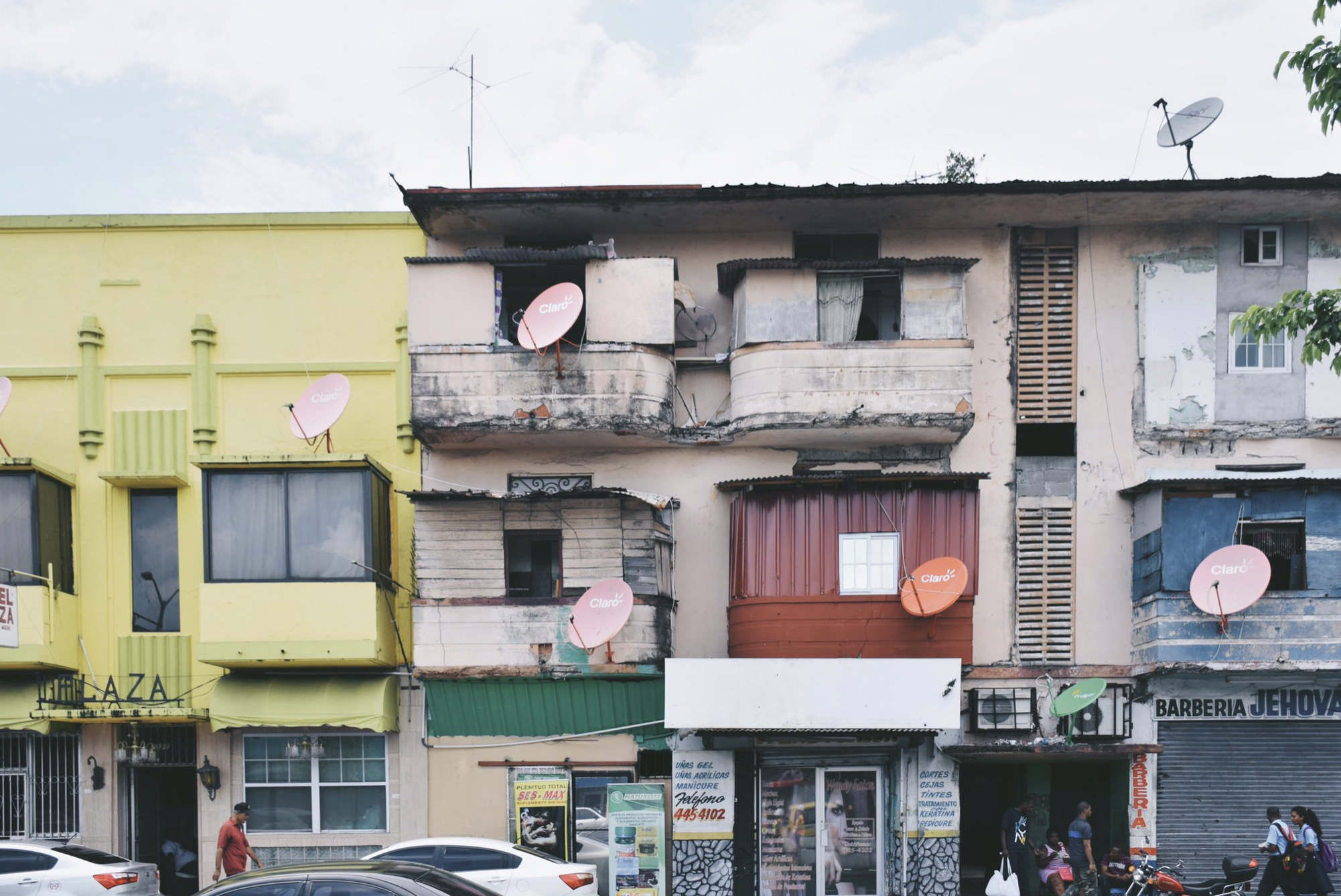
The original trace of Columbus, which is still preserved in the Old Town, is typically American and has no relation to the Hispanic urban tradition. In the first half of the twentieth century, Columbus developed a service economy that depended heavily on the port of Cristobal, the canal and the US military presence. In Panama; Its main bonanza period was World War II, when the US military presence reached its peak. The decline of the city began with the military reduction of the postwar period.
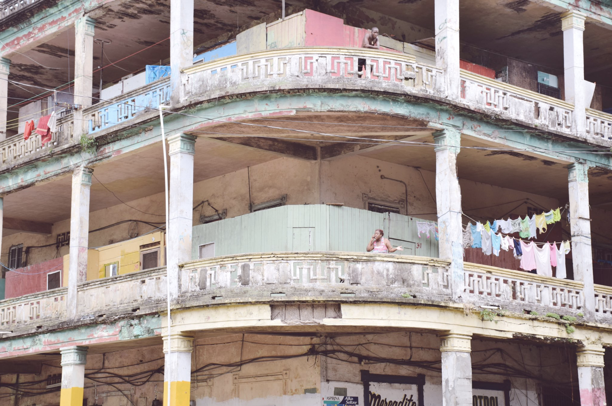
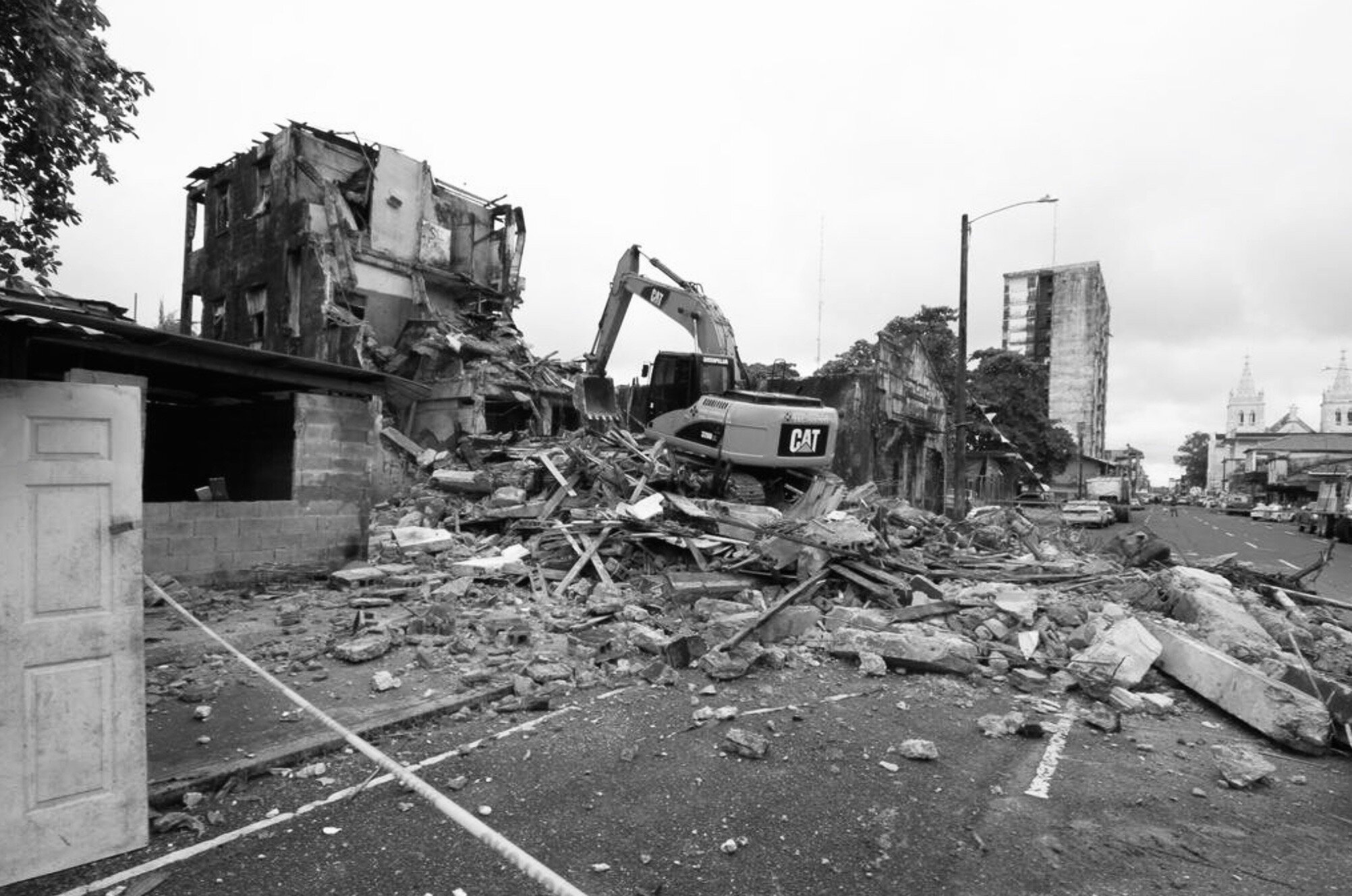
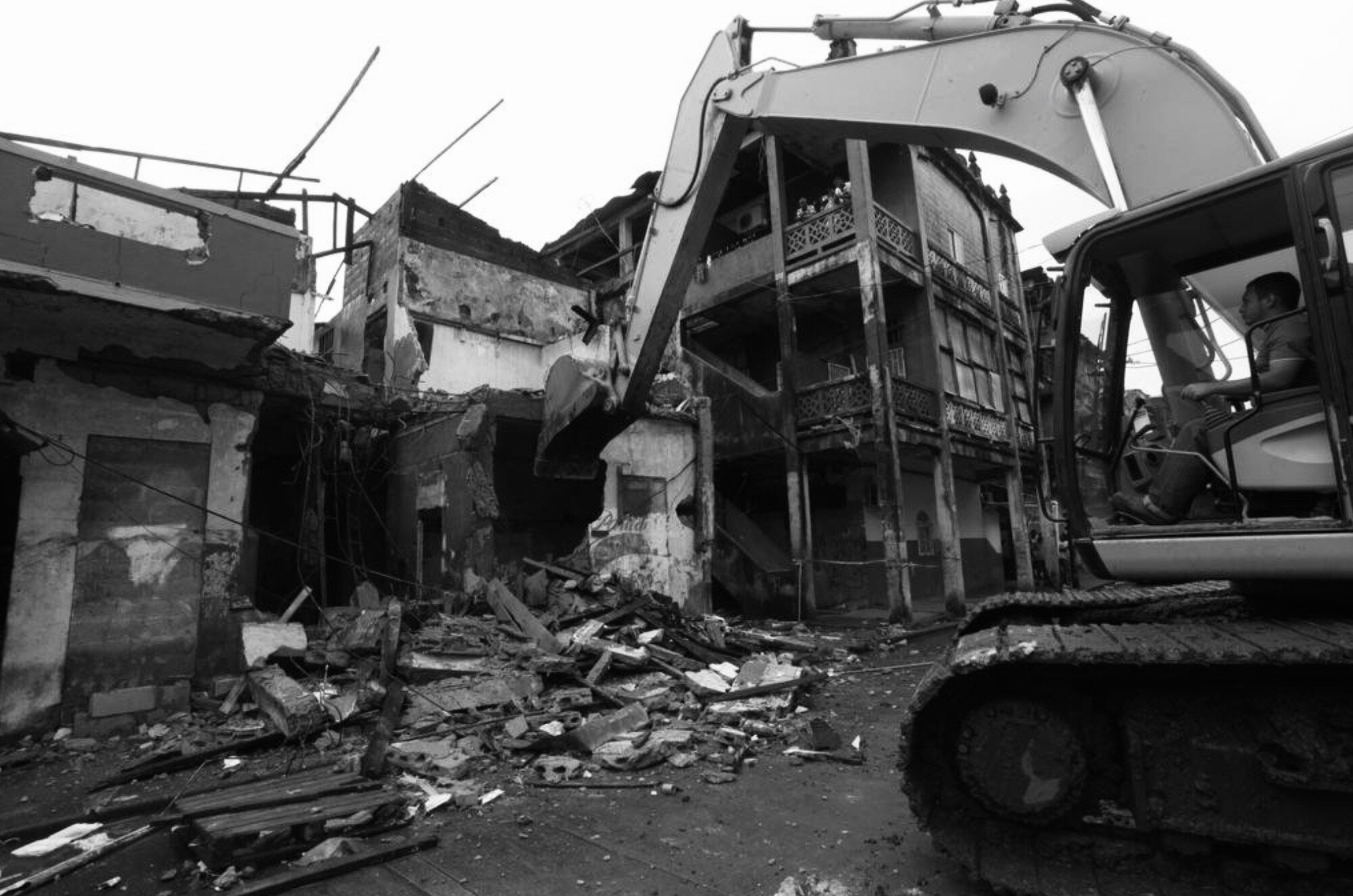
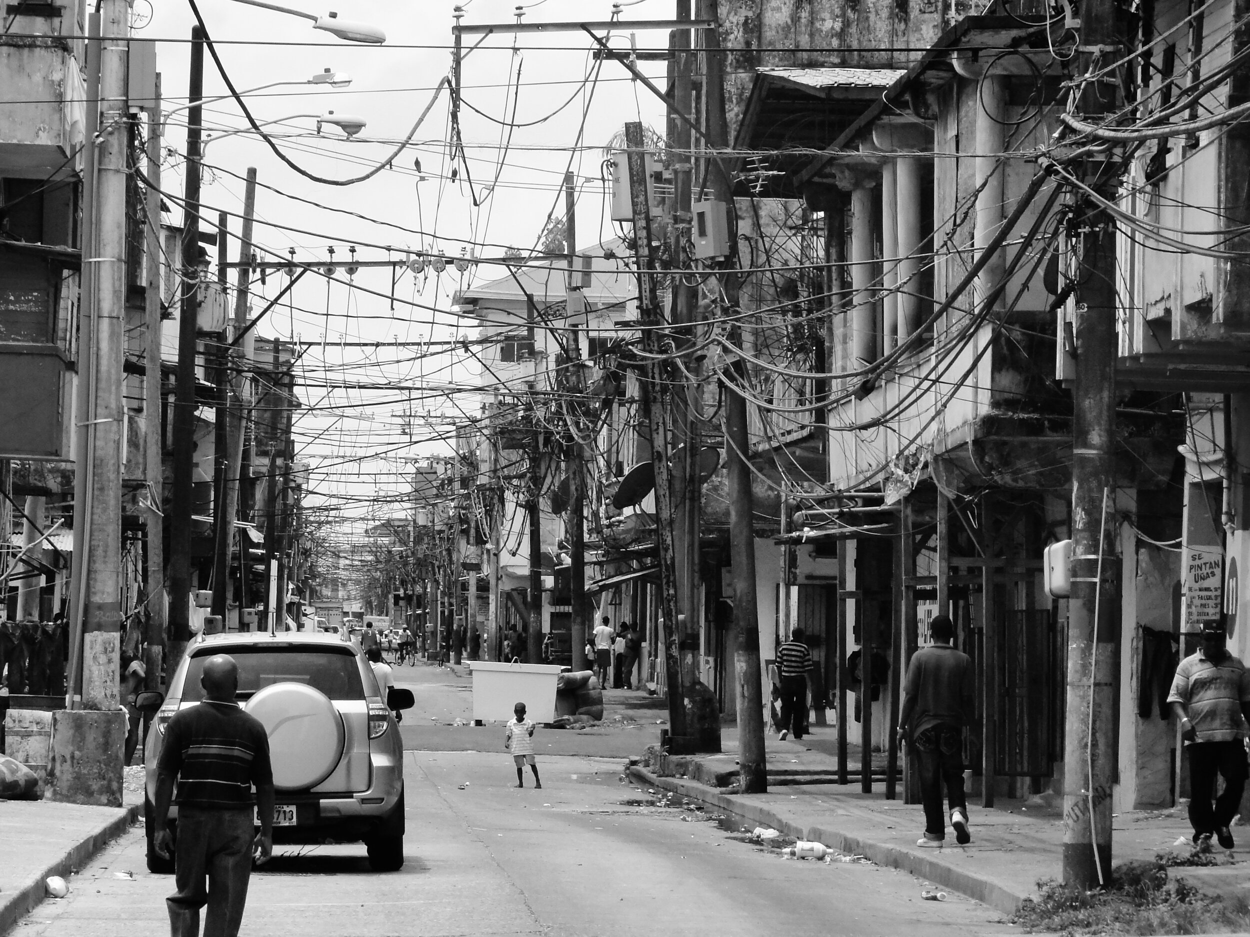
In the last thirty years, the growth and development of Columbus have focused on the periphery; The historic center - with the exception of the quadrant occupied by the Free Zone - has progressively deteriorated, and its architectural heritage is increasingly weakened.
That is why, within the framework of the Mega Renvación Urbana de Colón project, the boulevards that consolidate the urban layout are decided to intervene and are the heart of the city's public space through consolidation works, which maintain safety conditions without altering the formal characteristics nor functional since the city, due to its hinderland status, has developed a very strong, unique and territorial cultural identity that does not follow typical parameters of Panama or Central America itself. The renovation of this public space must, therefore, respect the historical design axes rather than propose new aesthetics designed by tangential readings - or rather superficial ones - of what the Caribbean culture represents.
Scarpetta, Richard, Cheng, Jonathan Cheng, Savogal, Lopera, Liliana
[Research and urban design]
Ciudad de Panama, Panama. 2015.
ENR’s 8th annual Global Best Projects. Winner Renovation/Restoration
Consulting and urban design. Project extension: 140,000 m2
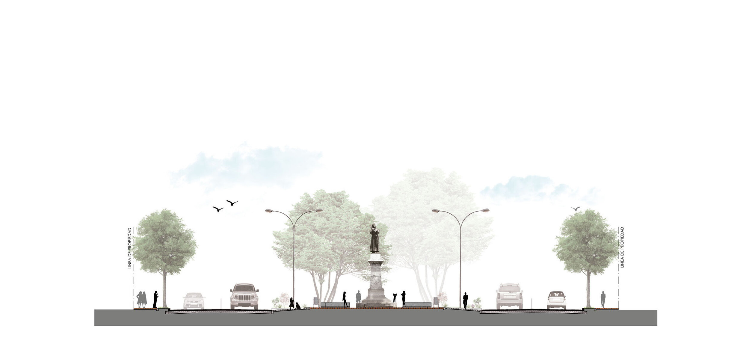
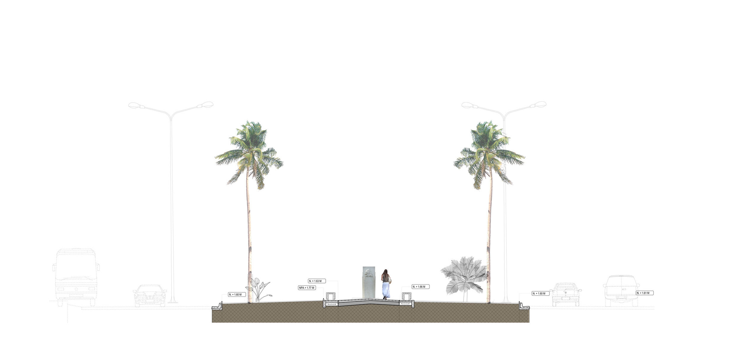
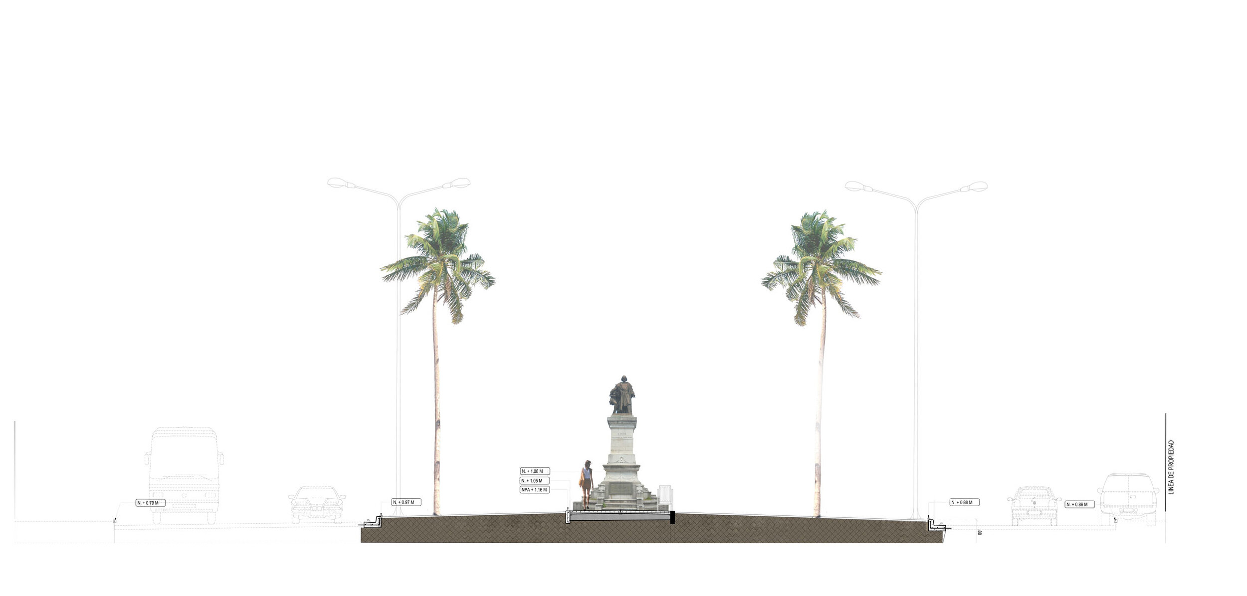
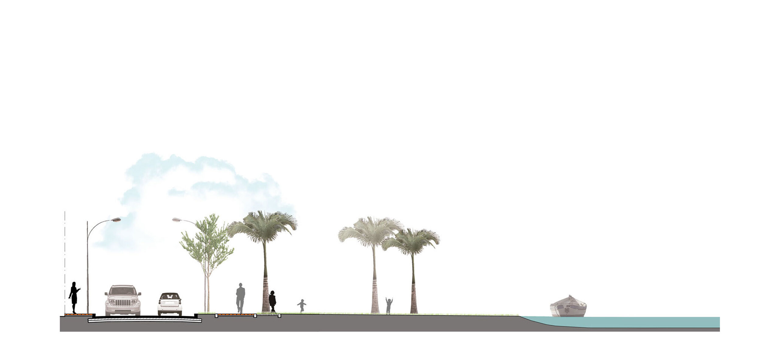
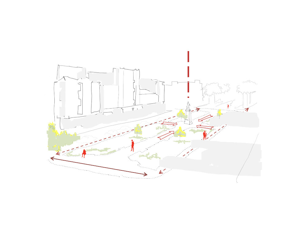
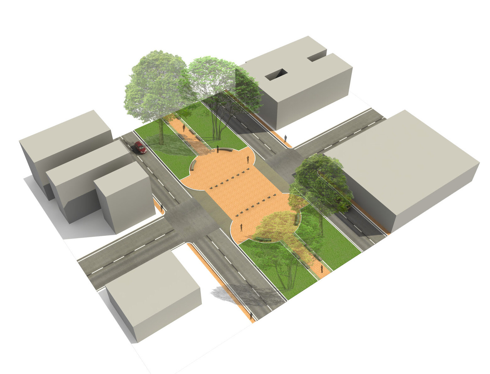
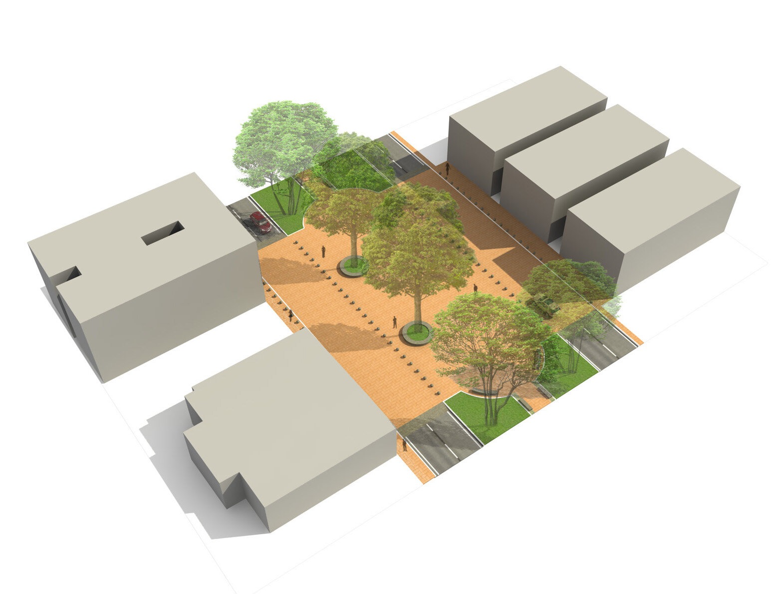
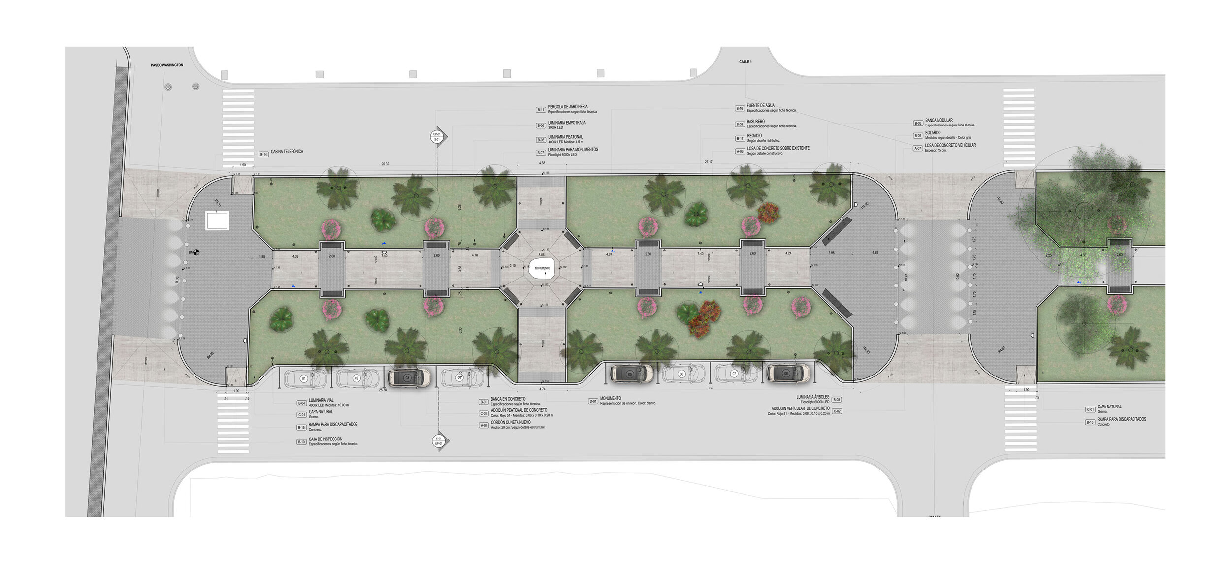
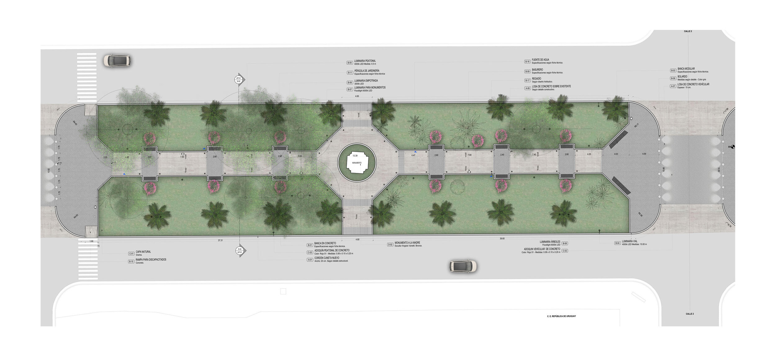
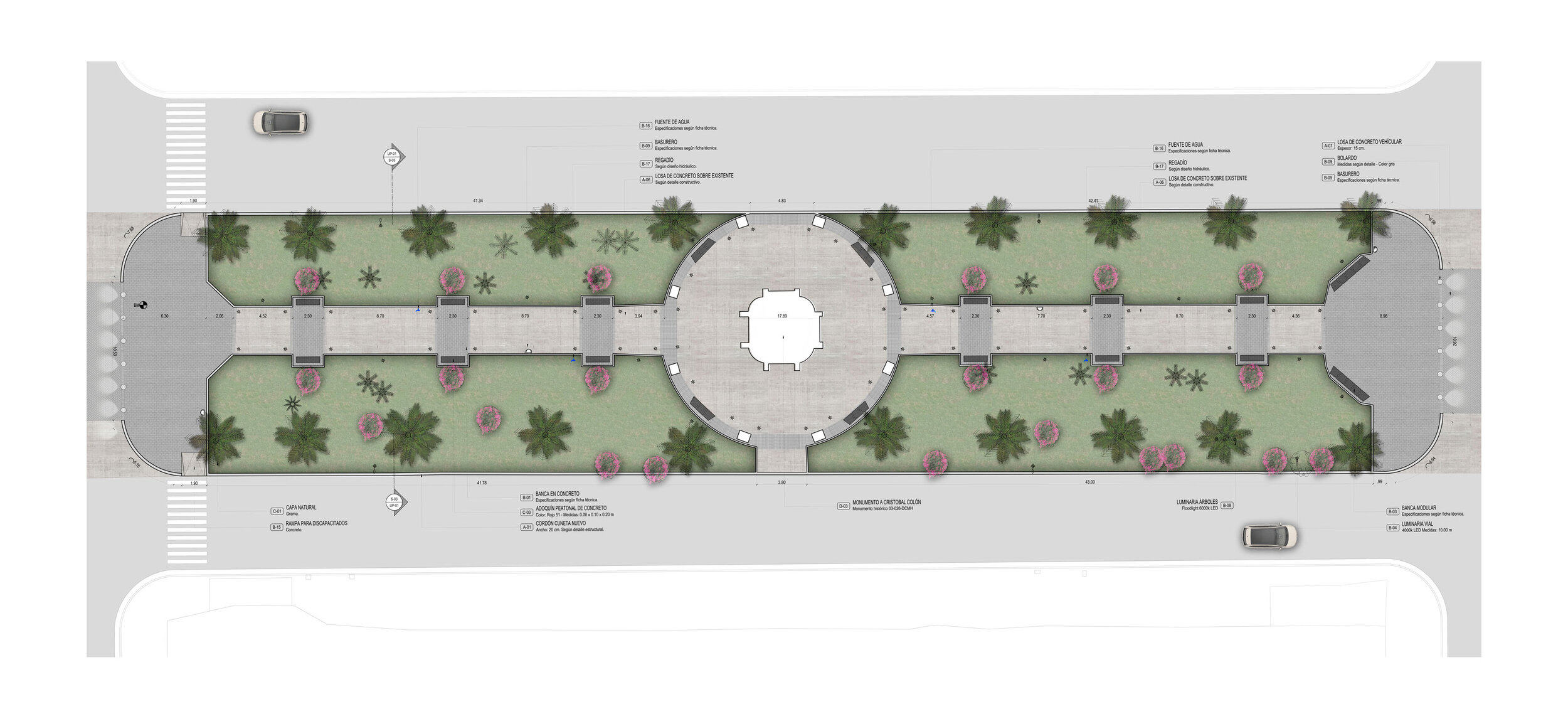
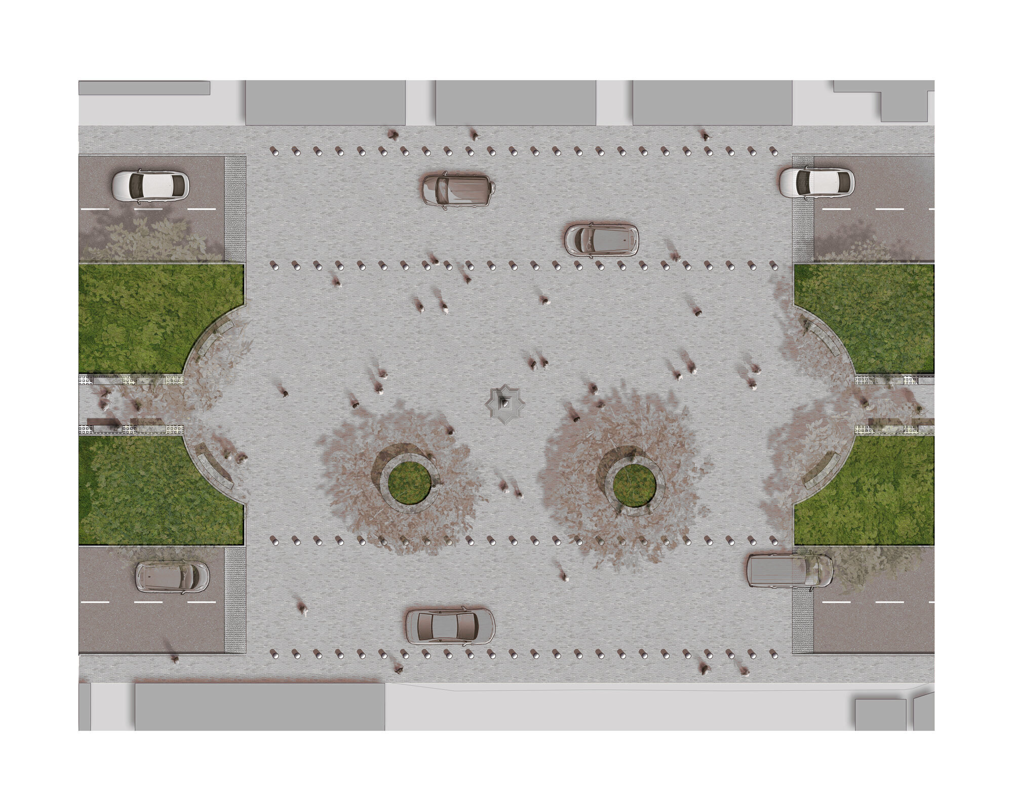
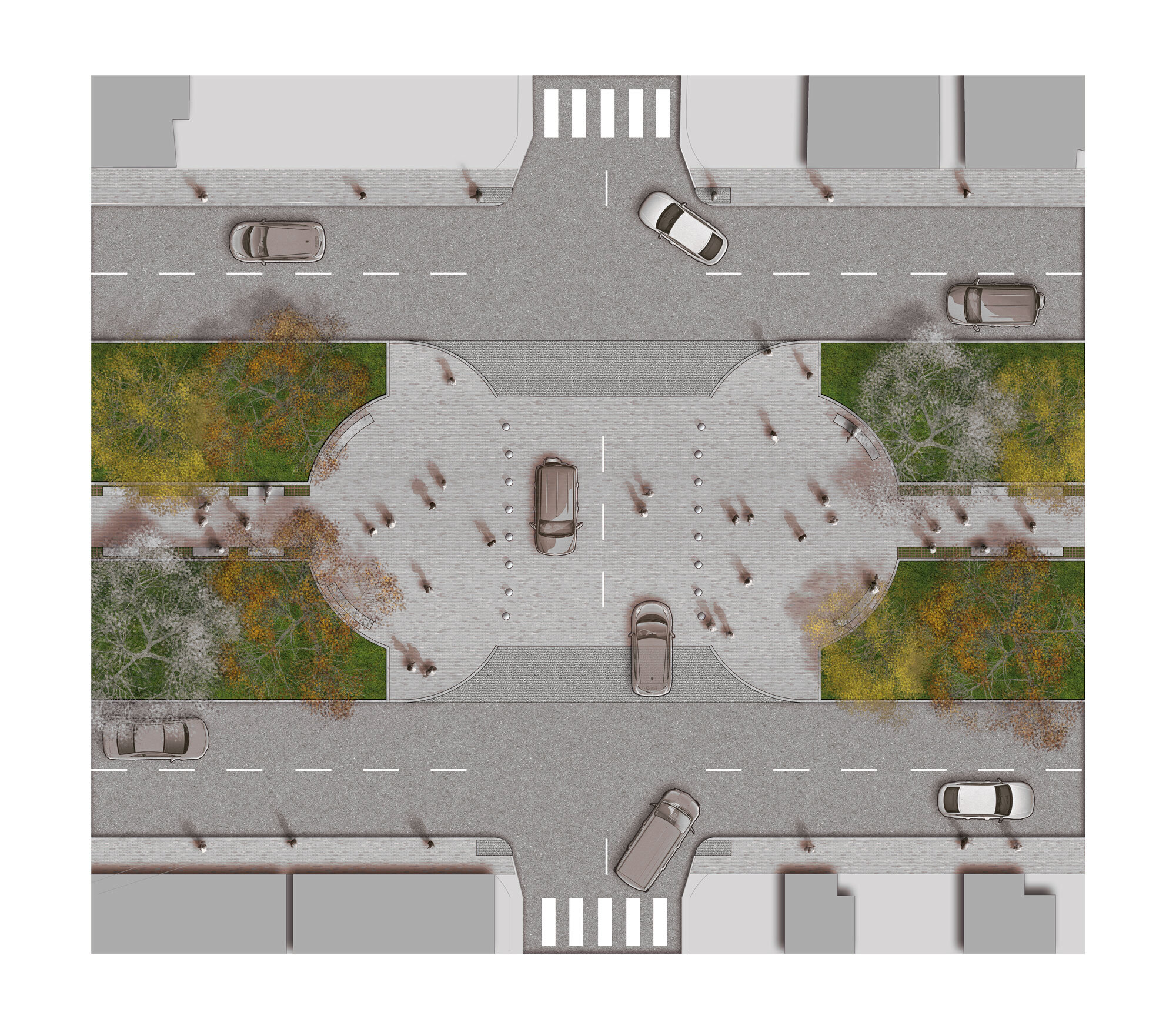
Historically, a boulevard is a communication route based on ancient defenses, since the word comes from the Dutch Bolwerk. It would allow, then, to surround a city on the outside like a peripheral belt. The boulevard is a generally important road (four traffic lanes or more) with wide pedestrian avenues on its sides. Its origin is located on the roads that were placed around the defensive fortresses of the cities. The plot and design of the sections responds to the landscape and urban design concepts created by the French in the 19th century, inherited by many of the parks and squares in Latin America. Singularly, Columbus was not conceived with a central square since its checkered structure is not Spanish / colonial. This is why the Central Avenue, although it is conceived as a boulevard or boulevard, each section behaves like a square.
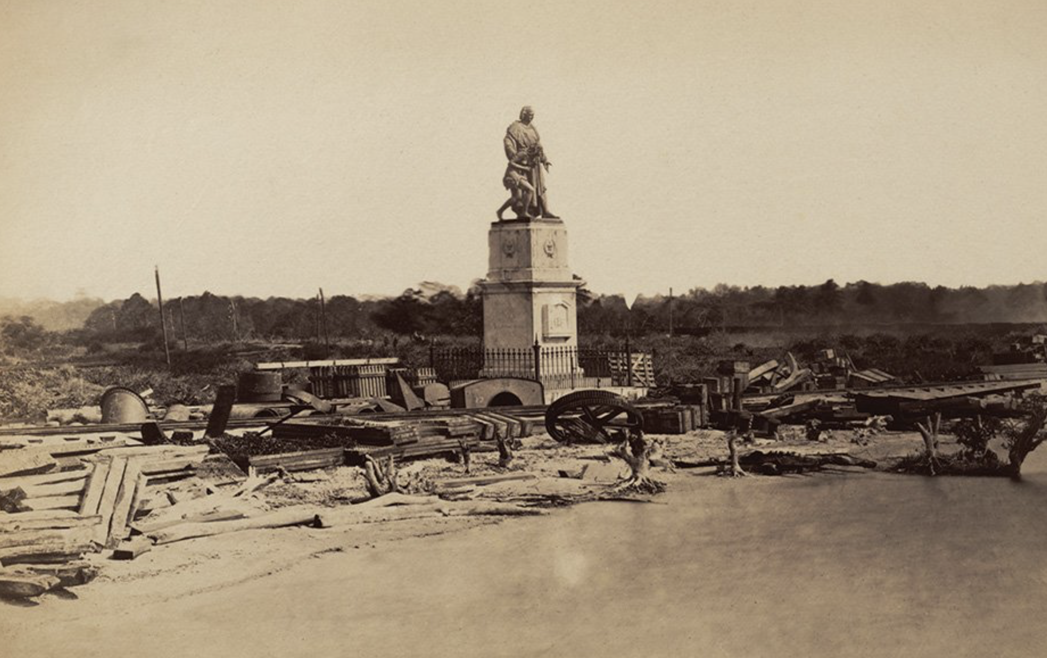
Precisely in Colon the central circulation in each square or islet is dominant, with a pedestrian crossing through the center of the section, linking the monument with the sidewalks. The monument then functions as a social or political exaltation and is revindicated as the heart and character of each islet. It is then that each one of the sections of the Centennial Walk look like archipelagos, with each identifiable identity: the Monument to the Mother, in section number two (for example) is between two schools and it is precisely in this place where the mothers meet Wait for your children. That is the identity and memory that cannot be lost in the design.
Urban reconstruction and historical critical memory.
While it is true that the scope of the project determines that the intervention of the public space of the Historic Center of Colon, is to make an improvement and physical intervention of its elements such as sidewalks, walks, furniture and landscaping, we must bear in mind that, the recovery of the center , is an integral process and can only be effective if it is integrated into a coherent conservation policy and / or plan for economic and social development.
From the above, we can easily identify that the relationship between public space and its problems, such as the perception of insecurity, transcends beyond the traditional urban planning of infrastructure production. These relationships are more linked to the sociocultural dimension of space, the use that social actors make of this and the perceptions that are formulated around it, since it is, through practices in the use of space, that meaning is provided collective to them.
The limitations that it faces, the public work of Columbus that will be carried out, go beyond those that affect typologies of an architectural, urban and / or commercial or residential nature, that because they are actions of notable impact on citizen life, they are exposed to greater control by the public and therefore must meet very diverse aesthetic, social and economic criteria, raising the need to redefine the public space as a dynamic living space.
The Centennial promenade currently has a priority in the historic center of Colón, due to the functional use of streets and sidewalks, its commercial and institutional preponderance, and central meeting point and passage space, the lack of attention to creation and renovation of public spaces, the high patrimonial value of urban and architectural complex, high historical content and physical deterioration, present in most of its buildings, are factors that have influenced the loss of the function of sociability of public space, and therefore in the generation of favorable conditions for its degradation, for criminal activities and for commercial activities without order or regulation.
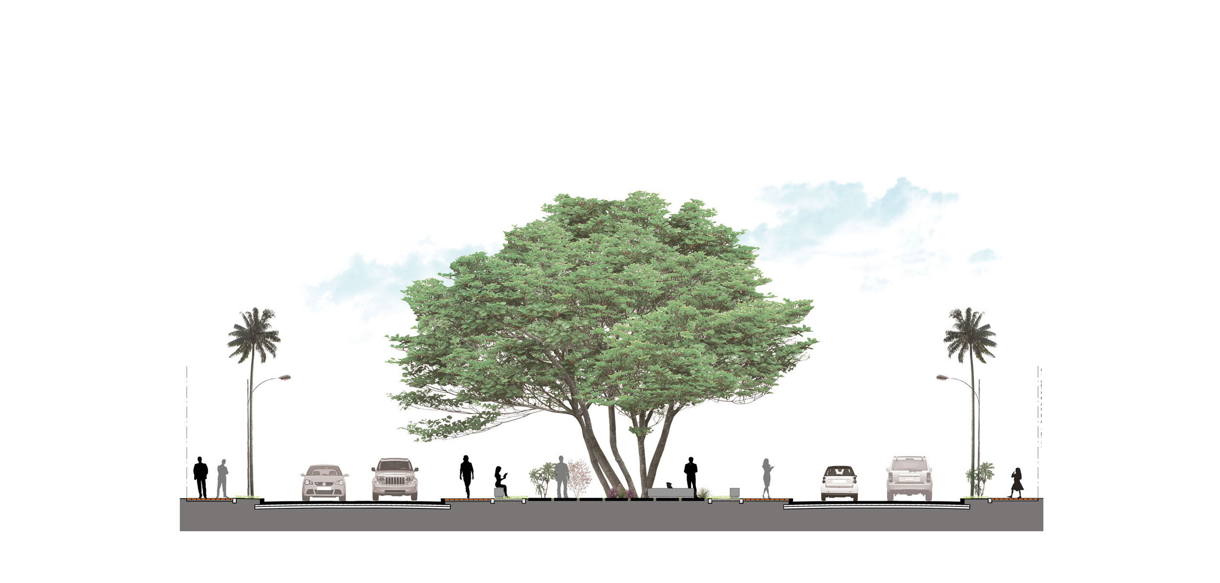
The original layout retrieval design of the central pedestrian walkway pattern; the circular squares destined to emblematic monuments and statues that give an account of the history of the city, and the function of the existing arborization, through gardening and rest areas under the shade of the trees. On the other hand, the physical and functional space is intervened and complemented by creating highlights where the vehicular track rises to the level of the pedestrian path, and the same material is installed in cobblestone to give continuity and priority to the pedestrian in all road crossings , along the central promenade, and the creation of squares that highlight buildings of high architectural value.

